METSERVICE HAS ISSUED SEVERE THUNDERSTORM AND HEAVY RAIN WATCHES FOR THE WAIKATO REGION
UPDATE: 10 NOVEMBER 2026: 8.00pm: MetService has extended the current Severe Thunderstorm Watch for the Waikato region. It now applies until 5:00am Wednesday 11 Nov. There is also a Heavy Rain Watch in place. Weather conditions can change quickly, so please take care and stay up to date with information from MetService. FOR THE LATEST WEATHER WARNINGS AND WATCHES, VISIT: https://www.metservice.com/warnings/home
UPDATE: 10 NOVEMBER 2026: 8.00pm
MetService has extended the current Severe Thunderstorm Watch for the Waikato region. It now applies until 5:00am Wednesday 11 Nov. There is also a Heavy Rain Watch in place.
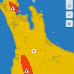
Weather conditions can change quickly, so please take care and stay up to date with information from MetService. Click the map to read more. For the latest weather warnings and watches, visit: https://www.metservice.com/warnings/home
Please call 111 regarding house flooding or emergencies. Phone Council on 0800 734 000 for any roading, water or sewerage issues.
𝗠𝗢𝗥𝗘 𝗜𝗡𝗙𝗢𝗥𝗠𝗔𝗧𝗜𝗢𝗡
Waikato Civil Defence advises that severe thunderstorms can produce localised downpours with rainfall rates of 25 to 40 mm per hour.
Rainfall of this intensity can cause surface and/or flash flooding, especially about low-lying areas such as streams, rivers or narrow valleys, and may also lead to slips.
𝗦𝗢𝗠𝗘 𝗨𝗦𝗘𝗙𝗨𝗟 𝗧𝗛𝗜𝗡𝗚𝗦 𝗬𝗢𝗨 𝗖𝗔𝗡 𝗗𝗢:
Drive with caution in heavy rain
If you see flooding, don't drive, walk, swim, or play in the water.
𝗨𝗦𝗘𝗙𝗨𝗟 𝗟𝗜𝗡𝗞𝗦:
Check for road closures: www.journeys.nzta.govt.nz/journey-planner
Get your household ready: www.getready.govt.nz
More News

CONNECTING WITH VOLUNTEERS – KING COUNTRY TRAINING
SEVERE THUNDERSTORM WATCH: 7 NOVEMBER 2026

THAI CENTRAL LIMITED ON LICENCE APPLICATION
REGULATORY SERVICES - TEMPORARY SERVICE DELAYS

PUBLIC LIBRARIES NZ COMMUNITY IMPACT SURVEY 2026